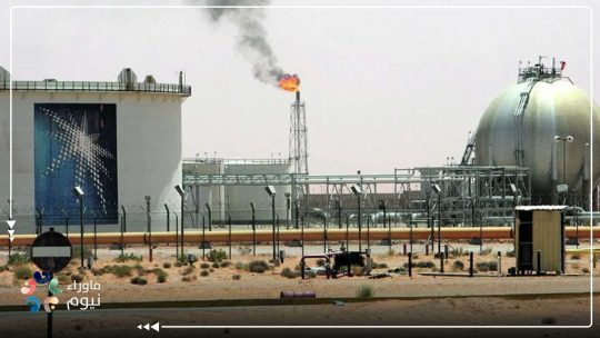
One image was enough to unravel an entire narrative. On March 26, 2026, U.S. Central Command released what appeared to be a routine military photo: a mid-air refueling operation involving a B-52 Stratofortress. But the caption told a different story. The bomber, CENTCOM confirmed, was on a combat mission supporting an operation named Epic Fury. What initially looked like standard documentation quickly turned into something far more consequential—a visual disclosure that airspace under Saudi control may have been used as a direct operational corridor for U.S. military action against Iran.
The implications were not speculative. Open-source analysts rapidly examined the background details of the image—lighting patterns, road networks, and urban layout—and matched them with satellite imagery of Rafiah in Saudi Arabia’s Eastern Province. Within hours, the conclusion circulating across analytical circles was clear: the refueling operation likely took place over Saudi territory. If accurate, this was not a minor logistical detail. It was evidence of functional involvement.
Visual Evidence and the Limits of Denial
The analysis was not guesswork. It followed established open-source intelligence methodologies similar to those used by investigative platforms like Bellingcat. By comparing geographic markers in the image with verified satellite data, analysts were able to pinpoint a location with high confidence.
What amplified the significance was not just the match—but the silence that followed.
Despite the rapid spread of the image and its analysis, there was no official denial from Saudi authorities. In a matter of this sensitivity—where sovereign airspace intersects with active military operations—silence does not read as neutrality. It reads as tacit acknowledgment.
CENTCOM, for its part, did not obscure the nature of the mission. The reference to a “combat sortie” linked to a named operation indicates that the image was not released inadvertently. It was deliberate. A message—likely aimed at Iran—but one that simultaneously exposed the operational geography behind it.
From Declared Neutrality to Operational Involvement
For years, Saudi Arabia has positioned itself as a stabilizing actor seeking to avoid direct escalation with Iran. Official messaging has consistently emphasized de-escalation, dialogue, and regional balance. The image challenges that narrative.
Allowing a strategic bomber such as a B-52—capable of long-range strike operations—to operate within or above Saudi-controlled airspace during a combat mission constitutes more than passive alignment. It reflects operational facilitation, even if not publicly acknowledged.
This pattern is not entirely new. Previous reporting, including a Reuters dispatch in August 2024, pointed to expanded U.S. military use of Gulf airspace and facilities without full public disclosure of host-nation roles. The strategy relies on managed ambiguity: enabling cooperation while maintaining a diplomatic posture of distance. But ambiguity has limits—especially when visual evidence emerges.
Airspace as Infrastructure: Strategic and Security Risks
The use of national airspace for active combat operations fundamentally alters a country’s position within a conflict.
According to assessments by the International Institute for Strategic Studies (IISS), states that provide logistical or operational support—whether through bases or air corridors—become part of the operational architecture of warfare. This classification carries consequences. It shifts them from observers to potential targets in any escalation cycle.
Strategic bombers are not neutral assets. Their presence signals high-intensity operations. Their routes define operational geography.
If Saudi airspace is integrated into such missions, even indirectly, it increases exposure across multiple dimensions:
Security risk: Potential retaliation targeting infrastructure or territory
Economic risk: Heightened geopolitical instability affecting investment flows
Political risk: Erosion of the credibility of declared neutrality
This creates a structural contradiction. On one hand, Saudi Arabia promotes itself as a stable investment destination under Vision 2030. On the other, its airspace may be facilitating operations that could draw it into a wider conflict.
Sovereignty Reframed: When Airspace Becomes a Corridor
The image released by CENTCOM was more than military documentation—it was a political document.
Airspace is not just geography; it is sovereignty. When it becomes a corridor for external military operations—especially without public acknowledgment—that sovereignty is effectively redefined.
What emerges is not a case of routine cooperation, but a model where strategic decisions are executed quietly, while their consequences remain public.
The official narrative continues to emphasize neutrality and stability. The operational reality, however, suggests something more complex: a system navigating between dependence on U.S. security architecture and the risks that come with it.
The Unavoidable Question
The issue is no longer whether Saudi Arabia is directly participating in military operations. The question is how far its territory—physical or aerial—has already been integrated into them. Because when bombers pass through your sky on combat missions, neutrality is no longer a position.
It becomes a claim under strain.